County: Jefferson County, Missouri
Nearest Town: Pacific
Trailhead: 38.435692, -90.675480
Distance from downtown STL: 37 minutes / 35 miles
Trail Length: 3 miles
Trail Format: Loop
Land Management: Myron & Sonya Glassberg Family MDC
Camping: Day Use Only
Watershed: Meramec River
Trail Maps:
8.5 x 11 PDF
GPS Track: (How to use GPS on your phone)
Glassberg 20171119
Area Map:
LaBarque Creek


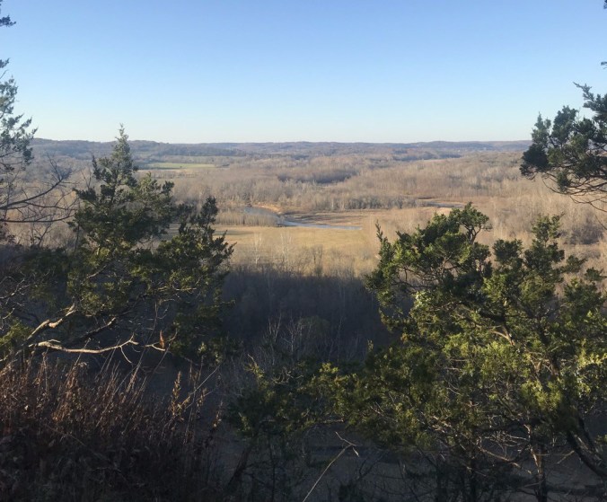
The Myron & Sonya Glassberg conservation area is a 429-acre tract in the LaBarque Creek watershed with impressive views across the Meramec River valley. A three-mile hiking trail loops through the area following ridge lines up, around, and back down to the valley. To reach the top, the trail utilizes an old gravel road, which near its steepest turns to asphalt. Single track begins at the overlook junction as the trail loops higher still and back around to the start.
The most impressive part of Glassberg is the ridge line that towers over the Meramec river, about one mile up the trail from the parking area. Take the spur to the scenic overlook but don’t turn back after snapping a few shots. Although not officially marked there are well beaten paths an additional 1/2 mile along the ridge line east of the wooden platform. There’s plenty to explore and at least a few Easter eggs in the area. The views are best in late fall or winter but watch your step along the cliffs.
