County: Iron County, Missouri
Nearest Town: Caledonia
Trailhead: 37.625771, -90.911125
Distance from downtown STL: 2 hours / 100 miles
Trail Length: 12 miles
Trail Format: Lollipop Loop
Land Management: Bell Mountain Wilderness Area
Camping: Backcountry
Watershed: Black River
Trail Maps:
8.5 x 11 PDF
8.5 x 11 JPG
11 x 17 PDF
11 x 17 JPG
GPS Track: (How to use GPS on your phone)
Bell Mountain GPX
Area Map:
Taum Sauk


The Bell Mountain Trail is usually hiked in a 12 mile lollipop loop beginning at the Highway A trailhead of the Taum Sauk section of the Ozark Trail. Make sure you start hiking on the correct trail to reach Bell Mountain. The trail crosses the street about 25 yards up the road (if you are in the parking area facing the road, turn left and the trail is on your right).
From Highway A, follow the Ozark Trail east for two miles as it switchbacks up Bell Mountain. You’ll pass countless glades with great views to the west. At around the 2-mile marker, the Ozark Trail reaches a saddle on Bell, and you’ll find a junction for Bell Mountain Trail to the north. Follow this for just over a mile and the next junction is at the bottom of the loop.
Taking a left to continue clockwise will drop you down into Joe’s Creek. The trail will continue for a two mile valley run before ascending back up. The trail crosses Joe’s Creek three times, and water is very reliable in this area. Unless flooded, these water crossings are generally rock hop-able.
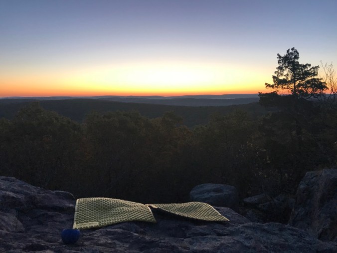
Taking a right at the bottom junction to continue counterclockwise will lead directly to the main attraction. The trail is set just to the side of a massive glade with breathtaking views to the east. Little side trails criss cross this entire area of prime backcountry camping real estate. Explore all the sights & sites before setting up camp. Each spot seems prettier than the next. Some are better suited for large or small group sizes, privacy, wind protection etcetera.
From the Highway A trailhead to the glade vistas atop Bell Mountain is around 8 miles taking the loop clockwise along Joe’s Creek. Only 4 miles if you go direct. There is also a wildlife pond between the bottom junction of the loop and the top glade area. But be warned, the pond is a bit on the murky side.
If the season is right and you are comfortable getting off trail, check out Shut-in creek 600 feet below. Plan your route while looking at a topo map. Hiking straight down the steepest area would be extremely dangerous. Start at the northern end of the glade and work down the ridge at an angle until you reach the creek. Then follow the creek downstream until you reach Shut-ins between Bell and Lindsey Mountains. You can sporadically pick up an old abandoned road that follows the creek on the west side.
