
County: Madison County, Missouri
Nearest City: Fredericktown
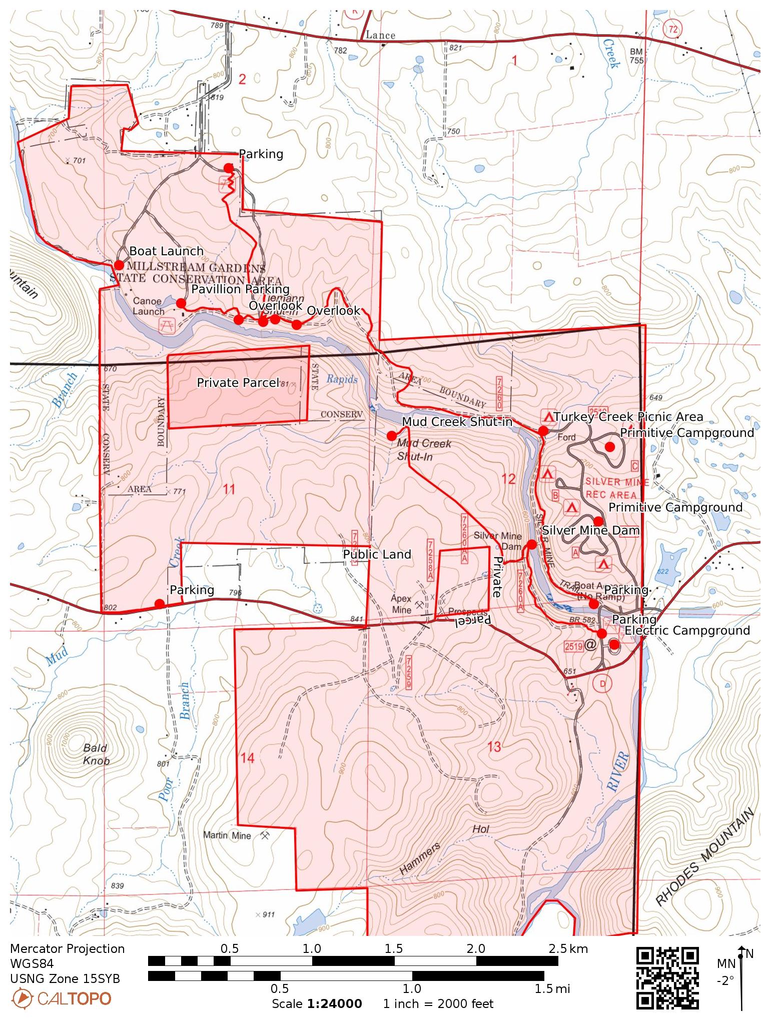
Trailhead: 37.553909, -90.437662
Distance from downtown STL: 1 hour 29 minutes / 95 miles
Trail Length: 1.5 miles
Trail Format: Out and back
Land Management: Millstream Gardens Conservation Area
Camping: No camping allowed
Shut-ins Location: 37.5642, -90.4522
Watershed: St. Francis River
Trail Maps:
8.5 x 11 PDF
8.5 x 11 JPG
GPS Track: (How to use GPS on your phone)
Mud Creek Shut-ins GPX


Mud Creek enters the St Francis River at the end of a long, deep pool below Tiemann Shut-ins. It is generally overlooked with everything going on at Millstream Gardens and Silver Mines and there are no trails to access the area. During the summer, or other periods of low water you can simply ford the St. Francis river to see it. If you are already hiking one of the three connecting trails that follow the river’s eastern shore it’s worth crossing to check it out.
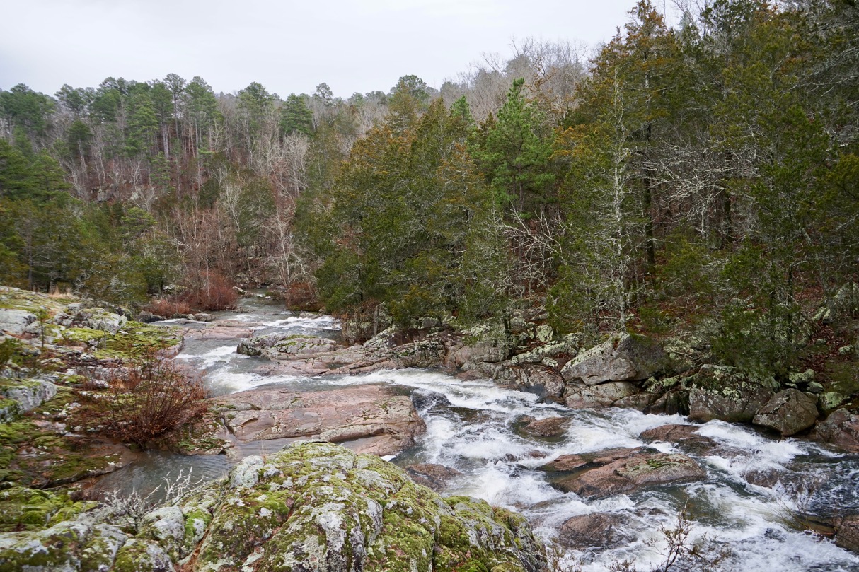
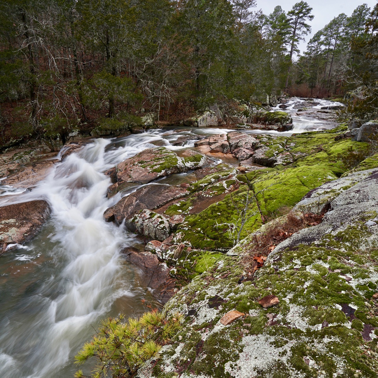
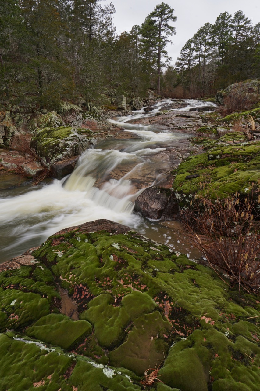
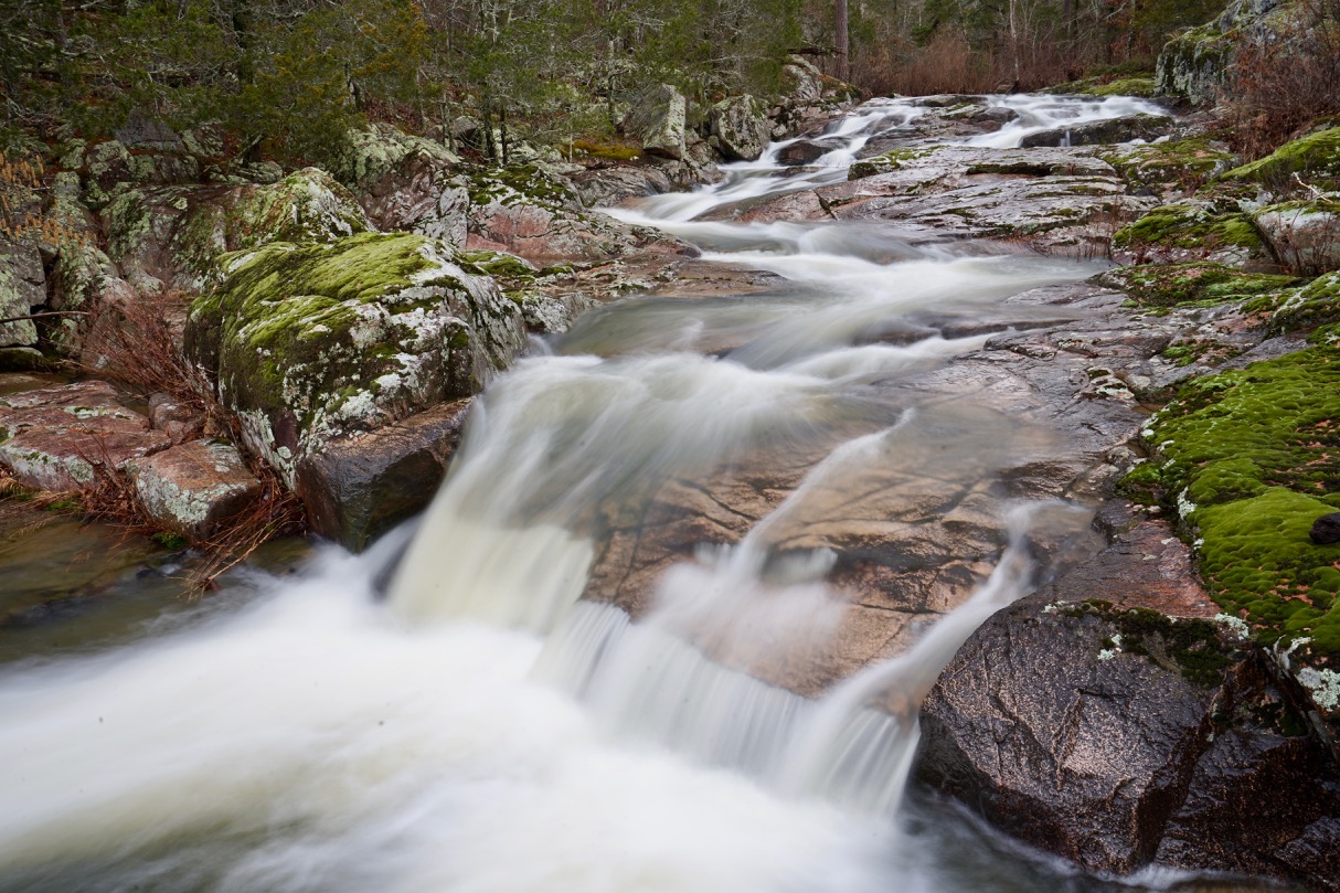
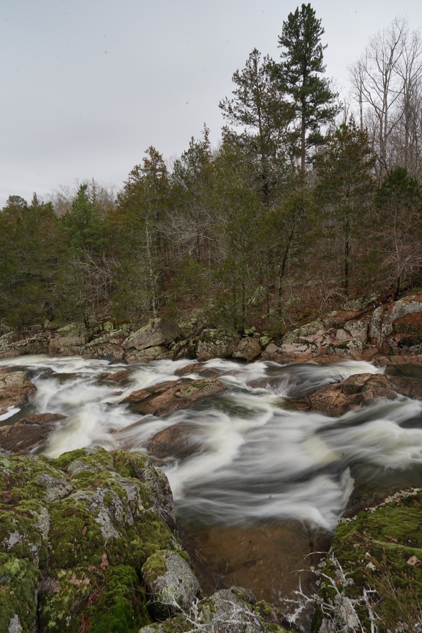
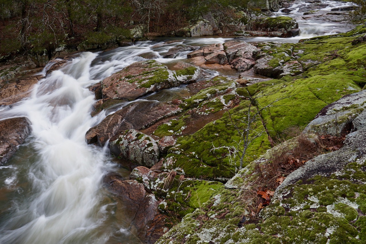
Even in low water conditions, Mud Creek shut-in is impressive. Massive growths of moss along its course give the whole area a magical vibe. A small campsite at the base of the shut-ins features a crystal clear plunge pool for cooling off on hot summer days. There’s usually enough water to set the mood of a trickling Ozark stream, albeit on a miniature scale, as it meanders through the large open rock garden.
With any considerable rainfall, the St. Francis river floods quickly so an alternative route is required to visit the shut-ins. For photography, this is the time that Mud Creek shines. Unlike most Missouri shut-ins, there is a significant drop in elevation over a very short distance here. It feels a lot like Rocky Falls, but bigger. That slow meandering trickle is transformed into a roaring falls as water inundates the area.
There are only a few options to approach Mud Creek from the west side of the river. The first is an MDC parking lot where Mud Creek crosses under highway D. Bushwhacking down from this access is not advisable. The route is muddy and cedar choked. It’s best to take the trail on the western river bank from the Silver Mines day use area up to the old dam. Then make your way off trail to the creek.
