County: Iron County, Missouri
Nearest City: Caledonia
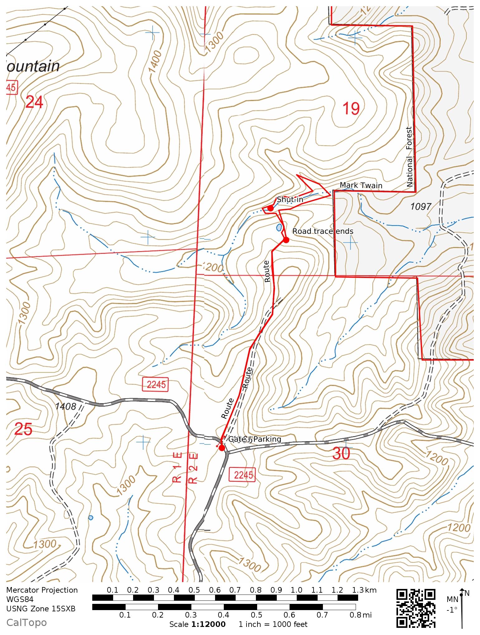
Trailhead: 37.7120, -90.8740
Distance from downtown STL: 1 hour 45 minutes / 97 miles
Trail Length: 2 miles (bushwhack)
Trail Format: Out and back
Land Management: Mark Twain National Forest
Camping: Primitive dispersed camping
Shut-ins Location: 37.7225, -90.8713
Watershed: Big River
Trail Maps:
8.5 x 11 PDF
8.5 x 11 JPG
GPS Track: (How to use GPS on your phone)
James Creek Tributary Shut-in GPX
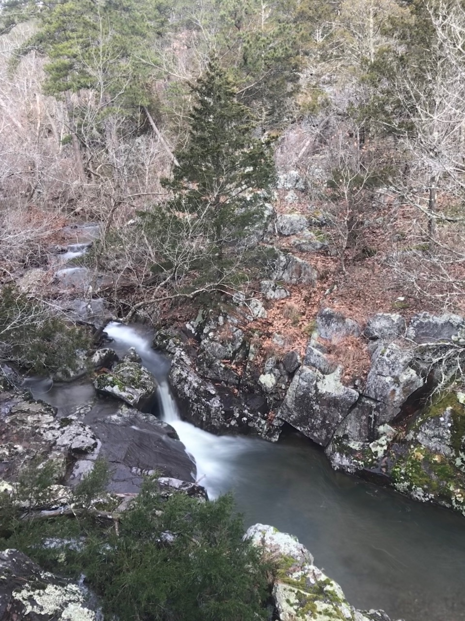


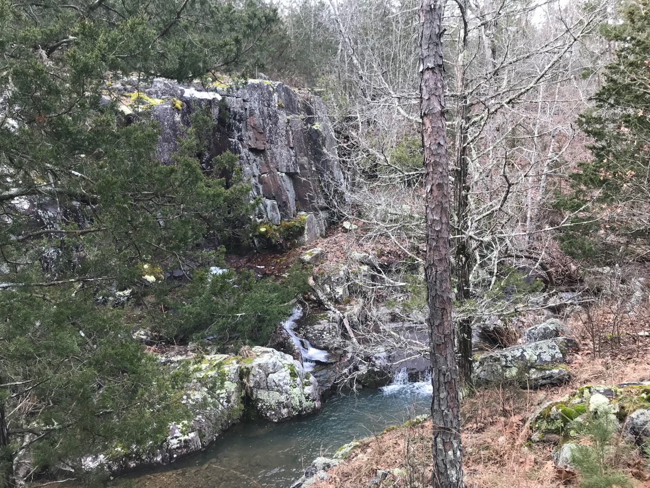


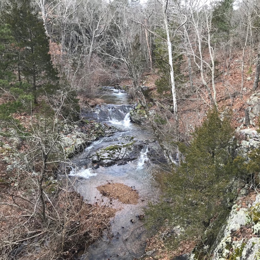
Located in an eastern drainage of Johnson Mountain this shut-in is undoubtedly named to avoid confusion with the renowned Johnson Shut-ins. In heavy rainfall the tumbling creek cascades over a boulder strewn path before entering a canyon-like ravine. Sheer granite walls rise on both sides of a narrow channel choked with the canopies of American Sycamores. Their papery trunks and intricate white branches contrasting with the black rock are truly magnificent.
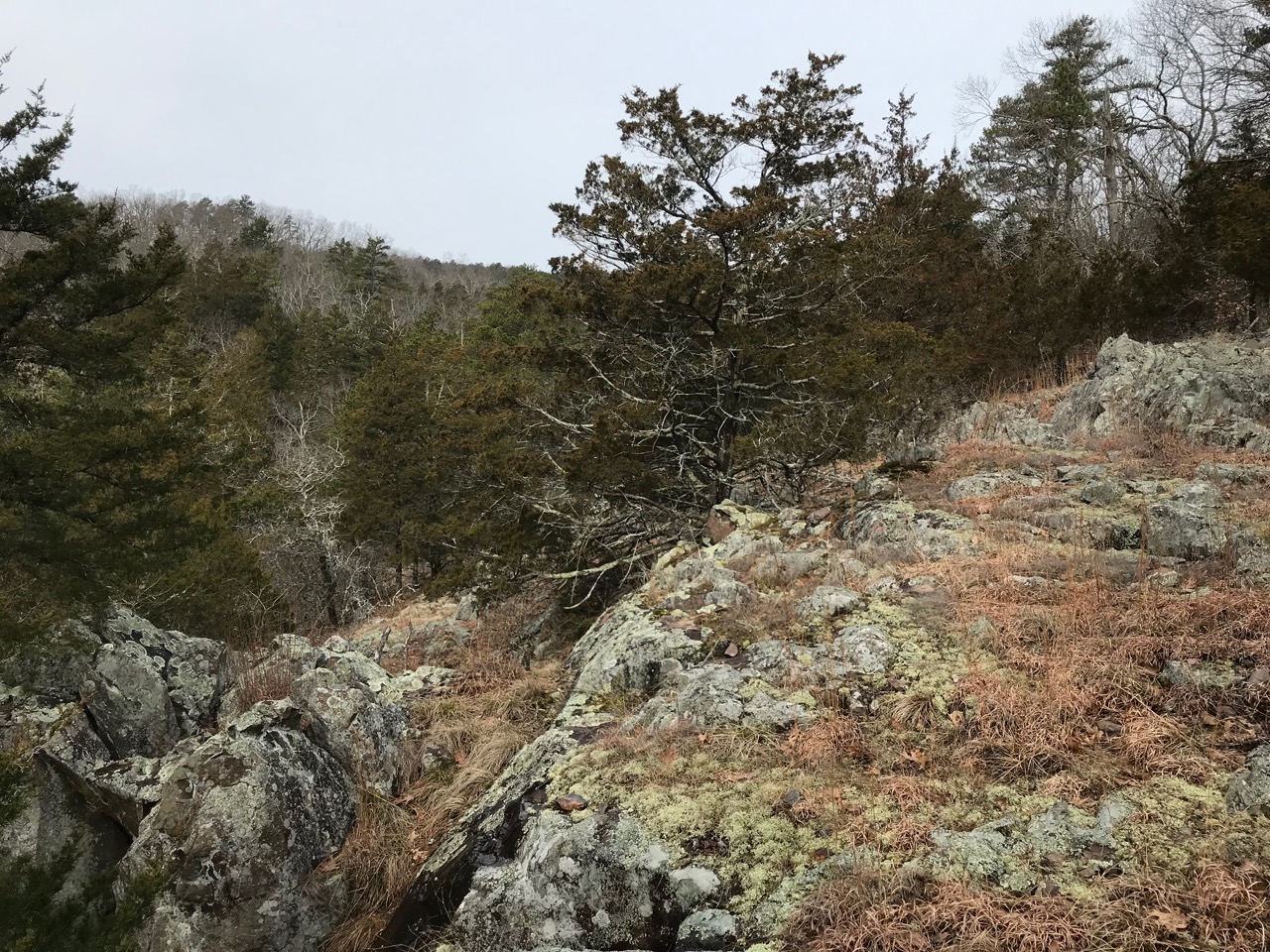
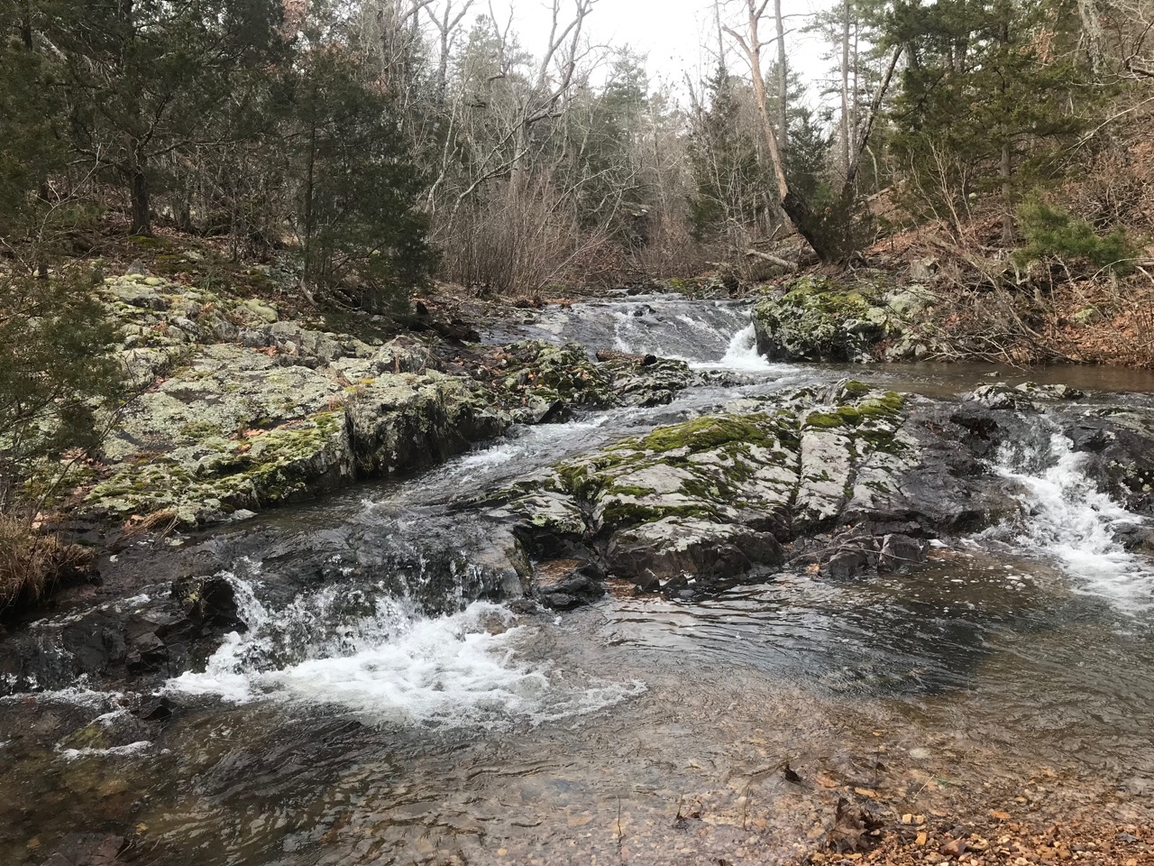
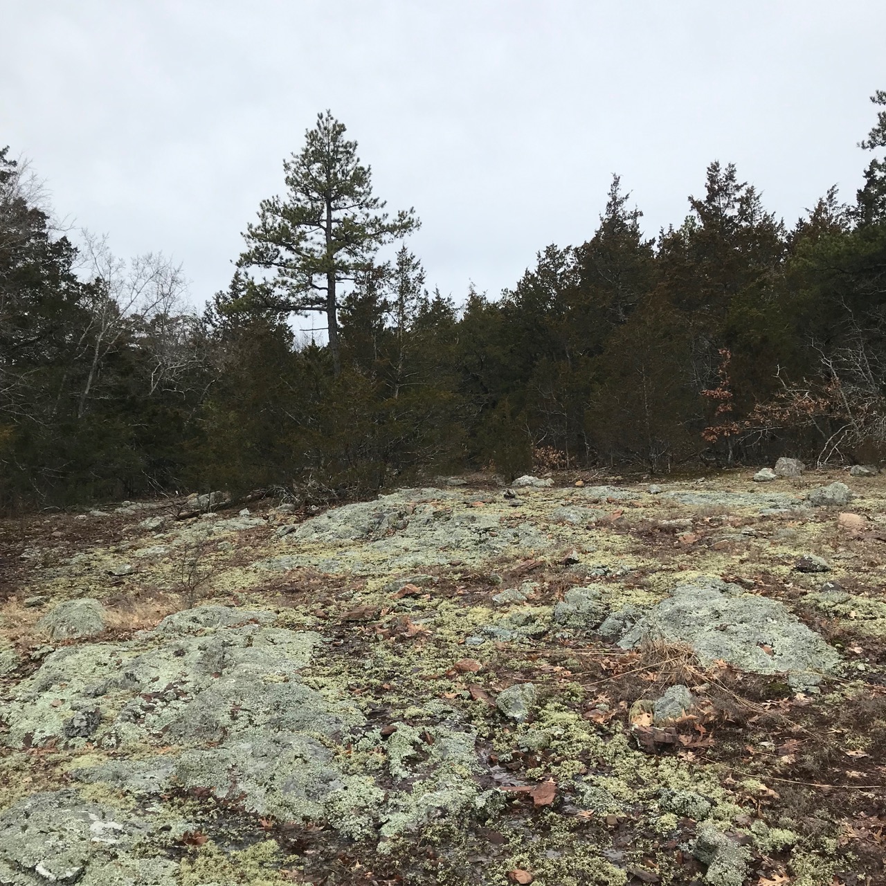
Downstream from the shut-ins is another picturesque drainage flowing in from the north which should not be overlooked. Johnson Mountain is dotted with countless glades and interesting rock formations. Many of these have a prominence significant enough to provide sweeping views of Council Bluff Lake and the surrounding countryside.
To quickly reach James Creek Tributary Shut-in, turn north off highway 32 onto forest road .7 miles west of junction with highway A. There is parking for a few cars on the side of the road near the often locked gate at 37.7120, -90.8740 . Shortly past the gate take a right following old road trace to the east for about .5 mile. Then make your way north passing a small pond before dropping into the creek. There’s a lot of new growth in this area so you’ll want to stay on the road trace for as long as you can to avoid a long walk in tight brush.
Nearby attractions include the Council Bluff Lake Trail, Enough Shut-in, Cub Creek Shut-in, Bell Mountain Wilderness Trail & Shut-in Creek.
