County: Shannon County, Missouri
Nearest City: Winona
Trailhead: 37.1263, -91.1987
Distance from downtown STL: 2 hours 45 minutes / 151 miles
Trail Length: 0 – 30+ miles
Trail Format: Out and back, Point to point
Land Management: Ozark National Scenic Riverways
Camping: Primitive dispersed camping
Shut-ins Location: 37.1267, -91.1983
Watershed: Current River
Trail Maps:
8.5 x 11 PDF
8.5 x 11 JPG
GPS Track: (How to use GPS on your phone)
Rocky Creek GPX

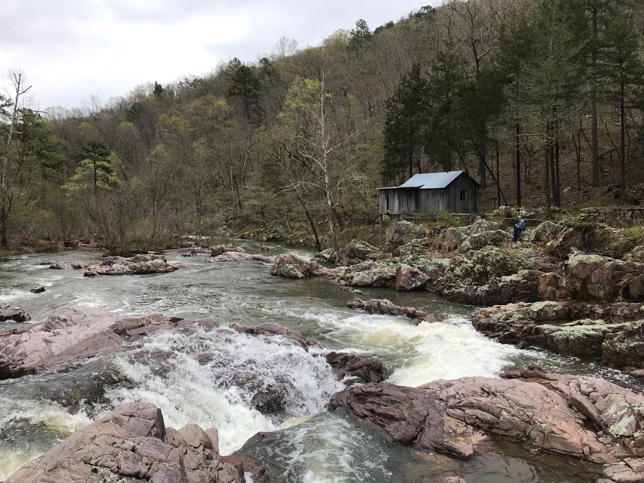
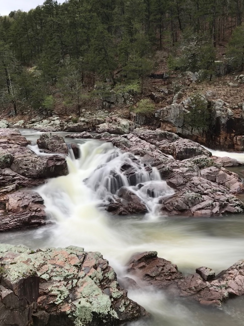

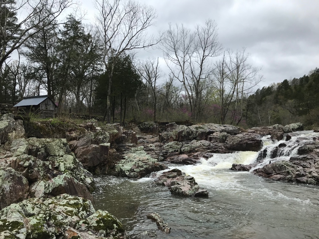

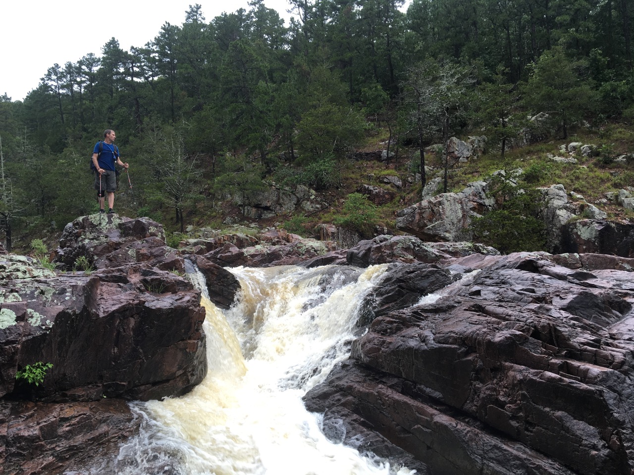

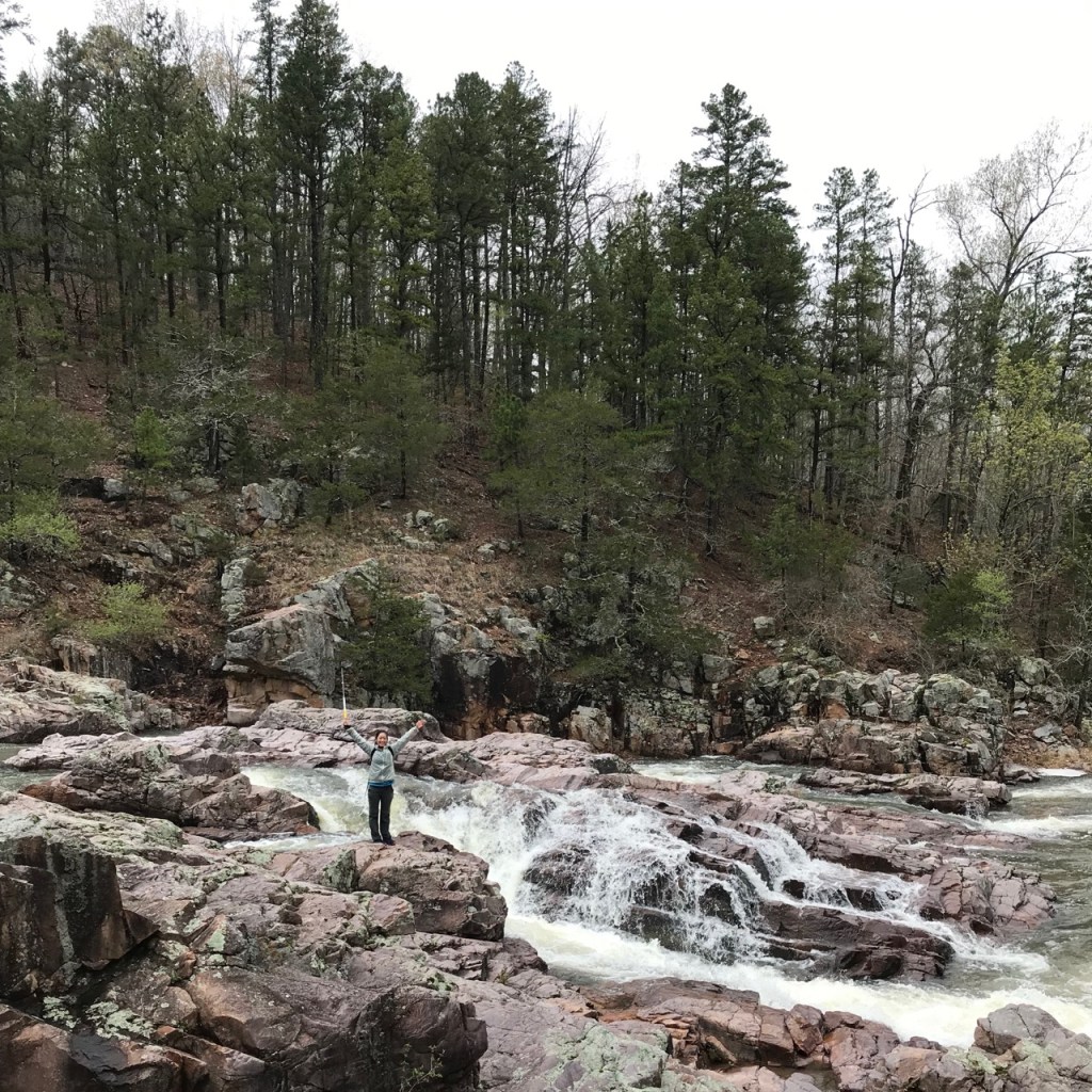
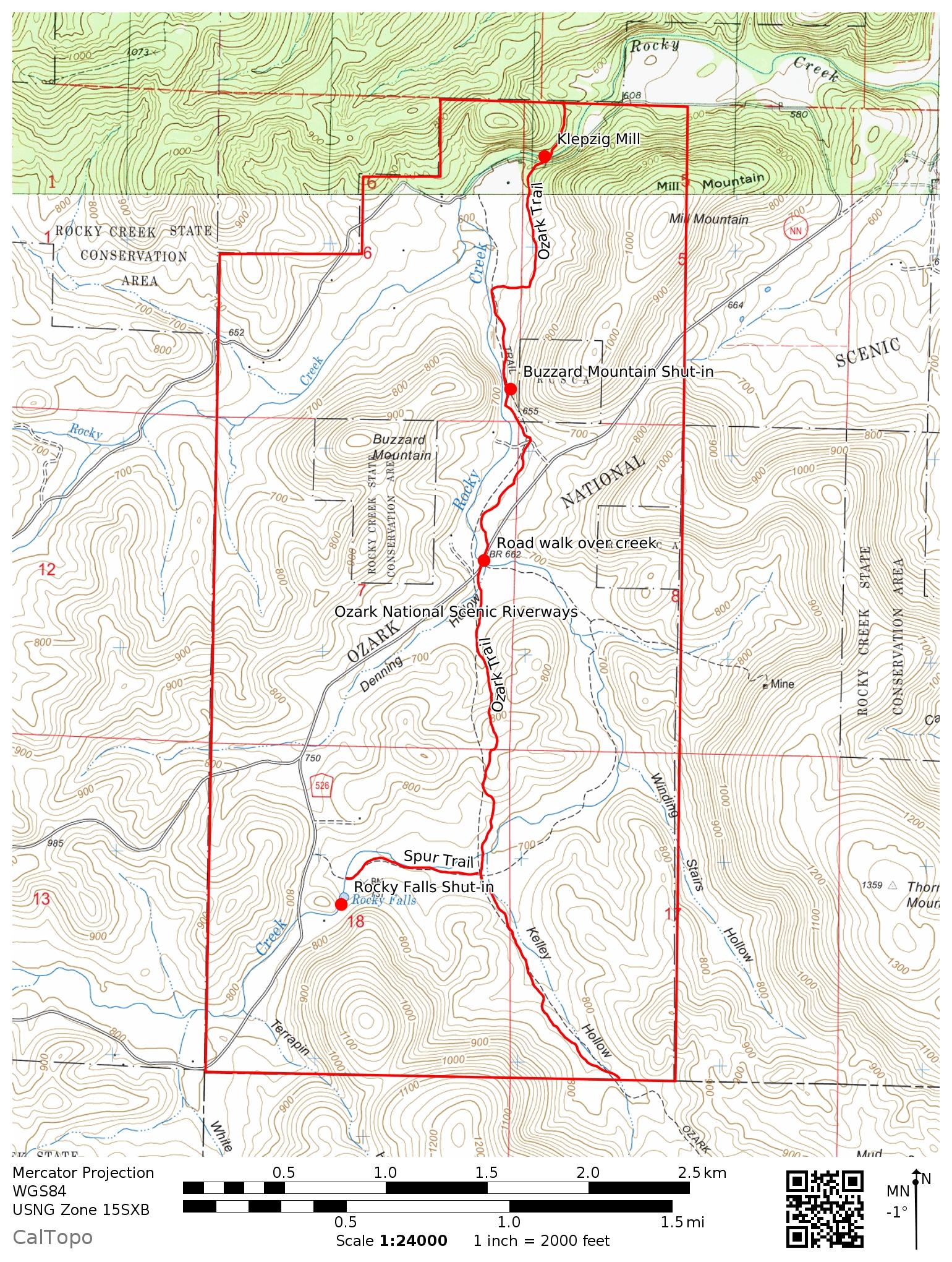
That last of three shut-ins along Rocky Creek, Klepzig Mill is the more common name for Mill Mountain Shut-in. Built by Prussian German immigrant Walter Klepzig, the site contains an early 20th century sawmill house, cement spillway and various other old foundations.
Klepzig is one of the larger shut-ins of Missouri and is great to photograph any time of the year. Varying water levels and backdrops from vibrant green to winter’s gray make each visit feel new and different. The shut-ins themselves are hues of pink to purple porphyry rhyolite that change depending on the light.
Consider photographing them in a late afternoon glow after pitching your tent along the state’s premier long distance backpacking trail. While the immediate area of Klepzig Mill is day use only, backcountry camping is permitted all along the Ozark Trail. Hiking the Current River section of the Ozark Trail is an absolute fantastic way to visit not only Klepzig Mill, but Buzzard Mountain Shut-ins and Rocky Falls.
You can reach Klepzig Mill by car taking Highway NN to County Road #522. The hike from Rocky Falls is less than three miles which makes a great day hike. That’s one awesome shut-in per mile – can’t beat it. Keep an eye out for wild horses that frequently graze in the public fields of this area.
Additional nearby attractions include Stegall Mountain Natural Area, Peck Ranch Elk Preserve (primitive camping) and Prairie Hollow Gorge.
